Charleston Flood Zones Explained
Last updated June 2026 by Brett Kelley, The TREAT Team. South Carolina License #96167. We live here and work flood-zone properties across the tri-county every week.
Here is the short version, because you came for an answer, not a scare. Your homeowner's policy does not cover flood in Charleston. Flood is a separate policy, and whether you are required to carry it depends on your property's FEMA zone: if you are in Zone AE or VE with a federally backed mortgage, it is mandatory. Since 2021, FEMA prices premiums on your specific property under Risk Rating 2.0, not just the color of the zone on the map, which means you have real levers to lower the cost. Check the zone, get the elevation certificate, and get a quote before you make an offer.
Flood is only one piece of the Lowcountry insurance picture. For why homeowners and wind premiums have doubled, and how to lower them, see our guide to Charleston homeowners insurance.
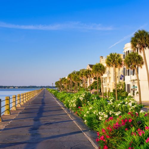
Now the longer read, because flood is the single most misunderstood part of buying in the Lowcountry, and the buyers who get hurt are almost always the ones who treated it as an afterthought. Charleston sits at an average elevation of about 20 feet above sea level and takes water from three directions: hurricanes, king tides, and heavy rain. Flood risk here is not a reason to walk away. It is a number you can find out, plan for, and often reduce.
How Do I Find Out a Property's Flood Zone in Charleston?
Three ways, and you should use more than one. The official source is FEMA's Flood Map Service Center, where you enter an address and pull the current Flood Insurance Rate Map. The City of Charleston also keeps flood records and a "Know Your Flood Zone" tool, and the city makes an important point that catches people off guard: every property in the City of Charleston is technically in a flood zone, but not all of them are in the FEMA Special Flood Hazard Area, which is the high-risk designation that triggers mandatory insurance. The difference between those two things is the difference between a manageable premium and a mandatory one.
Charleston County's current flood maps took effect on January 29, 2021, so any map you pull needs to be the current version, not an old PDF a seller hands you. When I am working a buyer through a specific property, this is the first thing I check, before we ever talk about an offer.
What Do the Charleston Flood Zones Actually Mean?
The zones are not just labels. They drive your requirements and your premium:
- Zone X: Minimal to moderate risk. Flood insurance is optional, though plenty of people in shaded X buy it anyway given the area.
- Zone AE: High risk, the 100-year floodplain. Mandatory insurance with a federally backed mortgage, and the most common high-risk zone you will see across the tri-county.
- Zone VE: Highest risk, coastal areas with wave action. Mandatory insurance and the strictest building codes.
- Zone AO: Shallow sheet-flow flooding, common in pockets across the region.
One newer wrinkle: the City of Charleston has enforced Coastal A Zone building standards since January 2023, which means newer construction in certain higher-risk areas is built tougher than older homes next door. That can actually work in your favor on insurance, which I will get to.
How Much Does Flood Insurance Cost in Charleston?
This is where Risk Rating 2.0 changed everything. FEMA now sets your premium on your specific property's elevation, distance to water, construction type, and rebuild cost, not just the zone on the map. Two houses on the same street, in the same zone, can carry very different premiums. That is why a neighbor's number or a two-year-old quote tells you almost nothing.
As a working range: low-risk Zone X properties often run $400 to $800 a year, coastal AE and VE properties commonly land between $1,500 and $4,500, and the worst-exposed properties go higher. Private flood insurance is also growing as an alternative to the federal NFIP program, and for some properties it beats the NFIP quote, so it is worth getting both. The only number that matters is the one written for the exact house you want, which is why you get that quote during due diligence, not after closing.
What Is an Elevation Certificate, and Why Does It Matter?
An elevation certificate is a document from a South Carolina licensed surveyor or engineer that records your home's lowest floor relative to the Base Flood Elevation. It is the single most useful piece of paper in the flood conversation, because under Risk Rating 2.0 and on any map-change request, your elevation drives your price.
A new certificate typically costs $300 to $600 and takes about five to ten business days. Before you pay for one, check whether the City of Charleston already has one on file for the property, because they keep records within their jurisdiction. If your home sits higher than the surrounding mapped floodplain, that certificate is also the first step to getting out of the zone entirely.
Can You Get a Property Out of a Flood Zone?
Sometimes, yes, and most buyers have never heard of this. It is called a Letter of Map Amendment, or LOMA. If your elevation certificate shows the lowest part of your property sits above the Base Flood Elevation, you can apply to FEMA to have the property officially removed from the Special Flood Hazard Area. A successful LOMA eliminates the mandatory insurance requirement and can drop your premium substantially, because the property is now treated as Zone X.
You can file it yourself at no cost, or pay a surveyor or consultant $500 to $1,500 to handle it. LOMAs are most common for properties near the edges of mapped zones, where topography creates higher ground inside a broader floodplain. One honest caveat: even after a LOMA, your lender still has the option to require flood insurance, so confirm with the bank before you bank on the savings.
How Do Charleston-Area Towns Lower Your Premium?
The town you buy in changes your flood insurance bill, and almost no buyer factors this in. FEMA runs a program called the Community Rating System, in place since 1990, that rewards communities for going beyond the minimum on floodplain management. Residents of participating towns get an automatic discount on NFIP premiums, and the better the community's rating, the bigger the discount. Charleston, Mount Pleasant, and North Charleston all participate. It is one of the few places where a decision about which municipality you buy in shows up directly on your insurance quote.
Which Charleston Areas Have the Most and Least Flood Risk?
Risk is always property-specific, but there are patterns worth knowing. The low-lying parts of the downtown peninsula take the most regular nuisance flooding from king tides. James Island and West Ashley both have seen FEMA map updates shift requirements in recent years, so they carry a real mix block to block. Johns Island spans everything from elevated lots to marsh-adjacent parcels. Mount Pleasant ranges widely depending on proximity to the water. Inland and higher-elevation areas like much of Summerville and parts of the Berkeley and Dorchester County suburbs generally carry lower risk, which is part of why they price more affordably per square foot.
None of that tells you about a specific house. It tells you where to expect the conversation to be easy and where to budget for it to be a real line item. The house is what gets checked, every time.
How Should Flood Risk Change How You Buy?
It should make you more precise, not more afraid. Newer construction built under Charleston's freeboard rules, which since July 2020 require new homes in the Special Flood Hazard Area to sit two feet above Base Flood Elevation, often insures better than an older home on the same block. A LOMA can move a borderline property into a different cost bracket entirely. And an elevation certificate in hand before you write the offer turns the biggest unknown in a Lowcountry purchase into a known number.
The buyers who get burned on flood are not the ones who bought in a flood zone. They are the ones who skipped the homework: no zone check, no elevation certificate, no real quote, and a payment that turned out to be a few hundred dollars a month higher than they planned. Do the work up front and flood becomes a math problem you solve, not a surprise you absorb. If you want a hand reading a specific property's flood exposure before you commit, that is exactly the kind of thing we do for buyers every week. Call the team at 843.738.2394.
For the bigger relocation picture, start with my Moving to Charleston guide, see how flood factors into the four-way area comparison, or find out what your current home is worth before you make a move.
Frequently Asked Questions About Flood Insurance
No. Flood is never covered by a standard homeowner's policy. You need a separate flood policy through FEMA's National Flood Insurance Program or a private flood insurer.
Enter the address at FEMA's Flood Map Service Center for the current Flood Insurance Rate Map, and cross-check with the City of Charleston's flood records. Every City of Charleston property is in a flood zone, but only those in the Special Flood Hazard Area face mandatory insurance.
It depends on the specific property under Risk Rating 2.0, but low-risk Zone X homes often run $400 to $800 a year, while coastal AE and VE properties commonly land between $1,500 and $4,500, and higher-exposure homes cost more. Always get a property-specific quote.
It is a surveyor's document recording your home's elevation relative to the Base Flood Elevation, and it is the key to accurate flood pricing. A new one costs roughly $300 to $600, though the City of Charleston may already have one on file for the property.
Possibly, through a FEMA Letter of Map Amendment if your elevation certificate shows the property sits above the Base Flood Elevation. A successful LOMA can remove the mandatory insurance requirement, though your lender may still choose to require coverage.